-
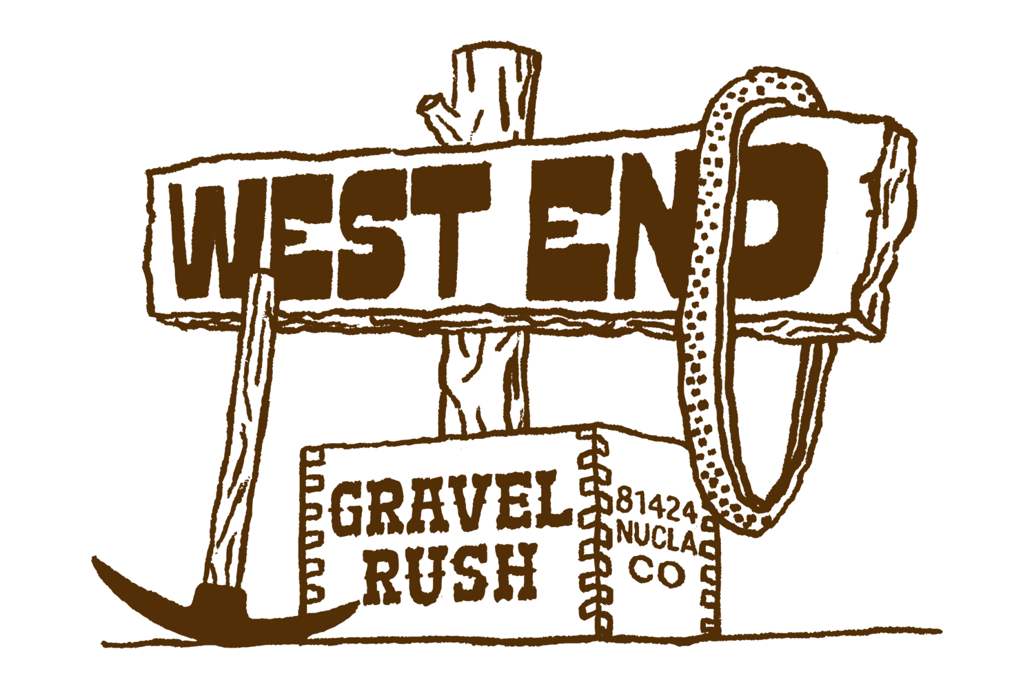
The Radium & Rustlers Bikepacking route
Tucked into the southwest corner of the Colorado Plateau, nestled between the La Sal and San Juan Mountain ranges, lies Colorado’s West End- a high desertscape with a few small communities seemingly frozen in time, sheltered from the chaos of larger cities and modern society.
The West End is a diverse landscape with solitude that is hard to match in this area of the country. Off the beaten path, the area spans an elevation range of 5,000 to 10,000 feet, with strong mining history in the desert canyons to the west, and ranching remaining strong at almost all elevations.
The Radium and Rustlers Bikepacking Route is intended to showcase the landscape and history of one connected community in two distinctly different loops. They can be ridden together as a larger loop, or ridden individually.

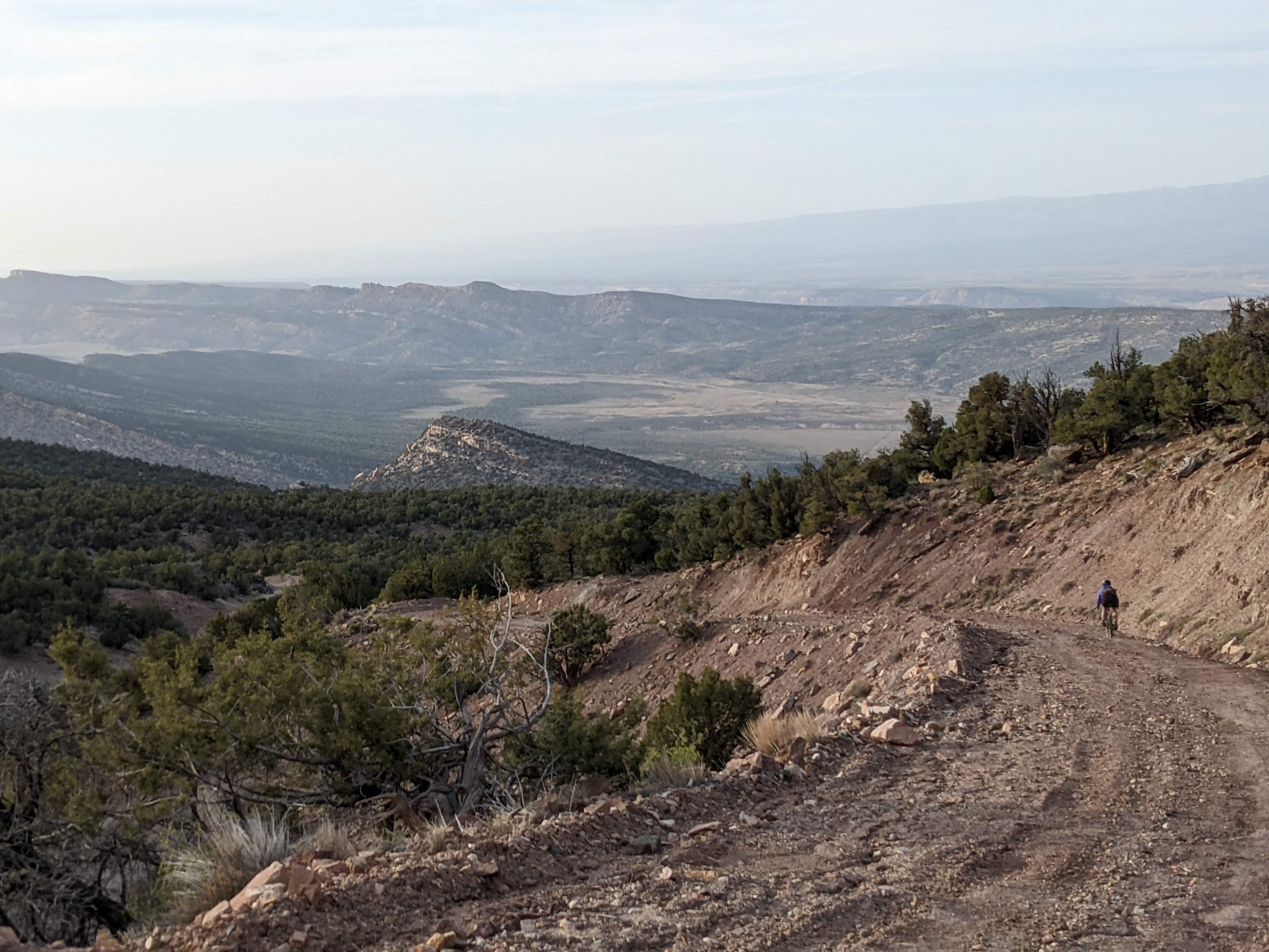
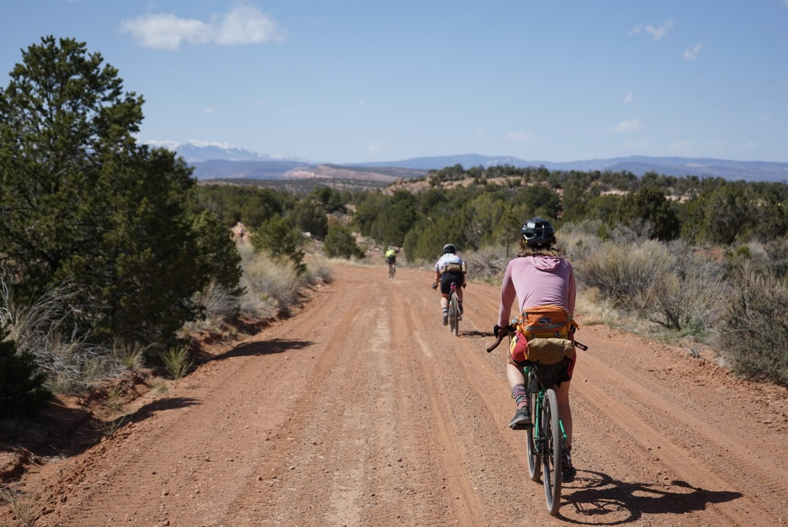
The Radium loop to the northwest, traverses desert mesas and deep sandstone canyons. Rich deposits of radium in the bedrock carved by the Dolores and San Miguel Rivers brought extensive mining activities to the area between the 1940s and 80s, with historical mining remnants still seen today. Most of the mining has vanished, leaving a labyrinth of quiet county dirt roads and abandoned double track, boasting amazing views. Up and down through canyons, washes and mesas, this loop boasts a substantial amount of rolling climbing and short fast descents. The MTB and Gravel editions vary greatly on this loop. The MTB route showcases more of the Paradox Trail, with Red Canyon, Saucer Basin and the Shamrock Trail highlighted. The gravel edition is still a bit bumpy, but focused more on county dirt roads, still with amazing desert views.

The town of Nucla was established by socialists in the late 1800s. Fail to hit the brakes and you might blow right through Nucla’s main street, which includes the Vestal House Bed & Breakfast, Genesis Coffee shop, Saucy Mama’s Food Truck, Wild Gal’s organic grocer and the 5th Ave Diner. At this point, if you chose to just ride the Radium loop, connecting back to Naturita is just a short spin down Highway 97.

To the east, the Rustler’s loop climbs gradually up to higher elevation in the Upcompahgre Plateau, transitioning from sage brush and scrub oak to dense aspen and ponderosa pines. Gone are the sandstone walls and deep canyons seen to the west, as the Uncompahgre National Forest takes over and the air turns crisp and cool close to 10,000 feet. Elk and deer reside in strong numbers here- a haven from heavy human traffic. Road surfaces tend to be smoother (and thus faster) on this side of the route. The MTB edition utilizes portions of the Paradox Trail, while the Gravel Edition stays on the well graded county roads.
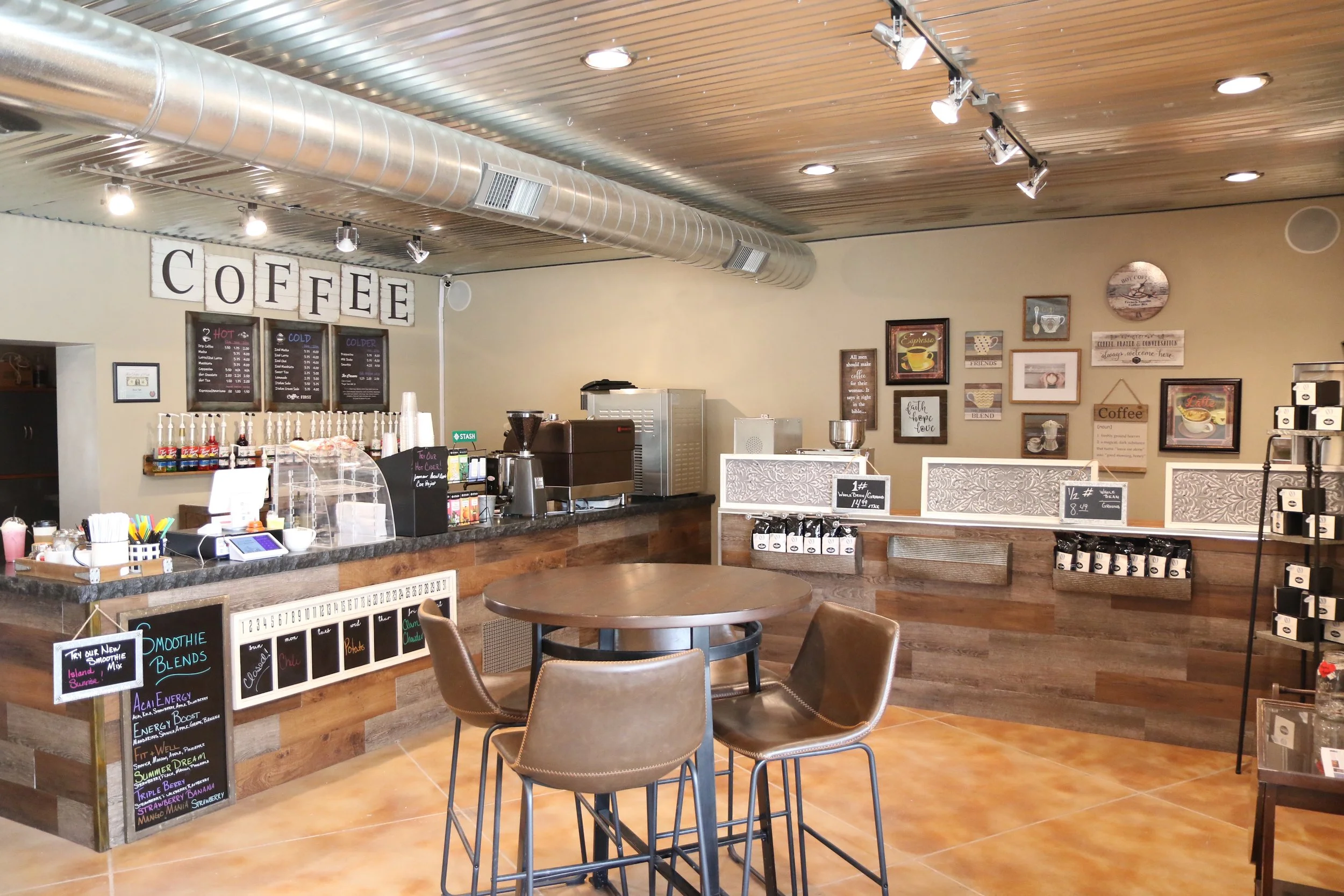
Norwood is the largest town on this route, albeit still a single block main street. High Country Bicycles is a great place to stop and see Phil and Lauren, talk bikes, and pick up any needed supplies. Mesa Rose Kitchen + Grocery is a recommended stop for coffee and tasty specialty sandwiches. Clarke’s grocer can provide what you need for the final stretch back to Naturita. Big views of Lone Cone Peak will accompany riders as you work in and out of the likes of McKee Draw. The MTB edition favors the Burn Canyon Trails, offering some fun and easy single track sections. Miramonte Reservoir brings a much needed water filtering stop, and can also be a great place to do some fishing and star gazing.
A resurgence can be felt as you take in the West End. It’s here, still faint, and you have to look for it. New businesses are springing up, and development is underway for a network of single track trails close to Naturita. The West End Arts movement is alive and well at CampV, and there is a strong bias towards revitalization in these communities.
This route is considered to be 7/10 on the difficulty scale, and is likely a 3-4 day outing for most. Beginner bike packers should use caution on this route, and consider breaking up the loops. Most technical areas can be bypassed, which can bring down the rating slightly. What makes the riding challenging is the consistent undulation of the terrain, potential for heat and planning for water resupply. The area, especially the Radium loop, has an ample amount of moderate length, stiff climbs, as you work in and out of valleys, canyons and washes. This, along with significant heat in the dead of summer, can make travel slower than expected. With each loop coming back to town centers, riders can determine if they would like to accomplish both loops, or just one. Several access points to the San Miguel River provide water filtering options, but water between those points (and between services) is likely scarce. It is the high desert, so be ready to carry a good amount of water in general, relative to the forecast.
Highlights
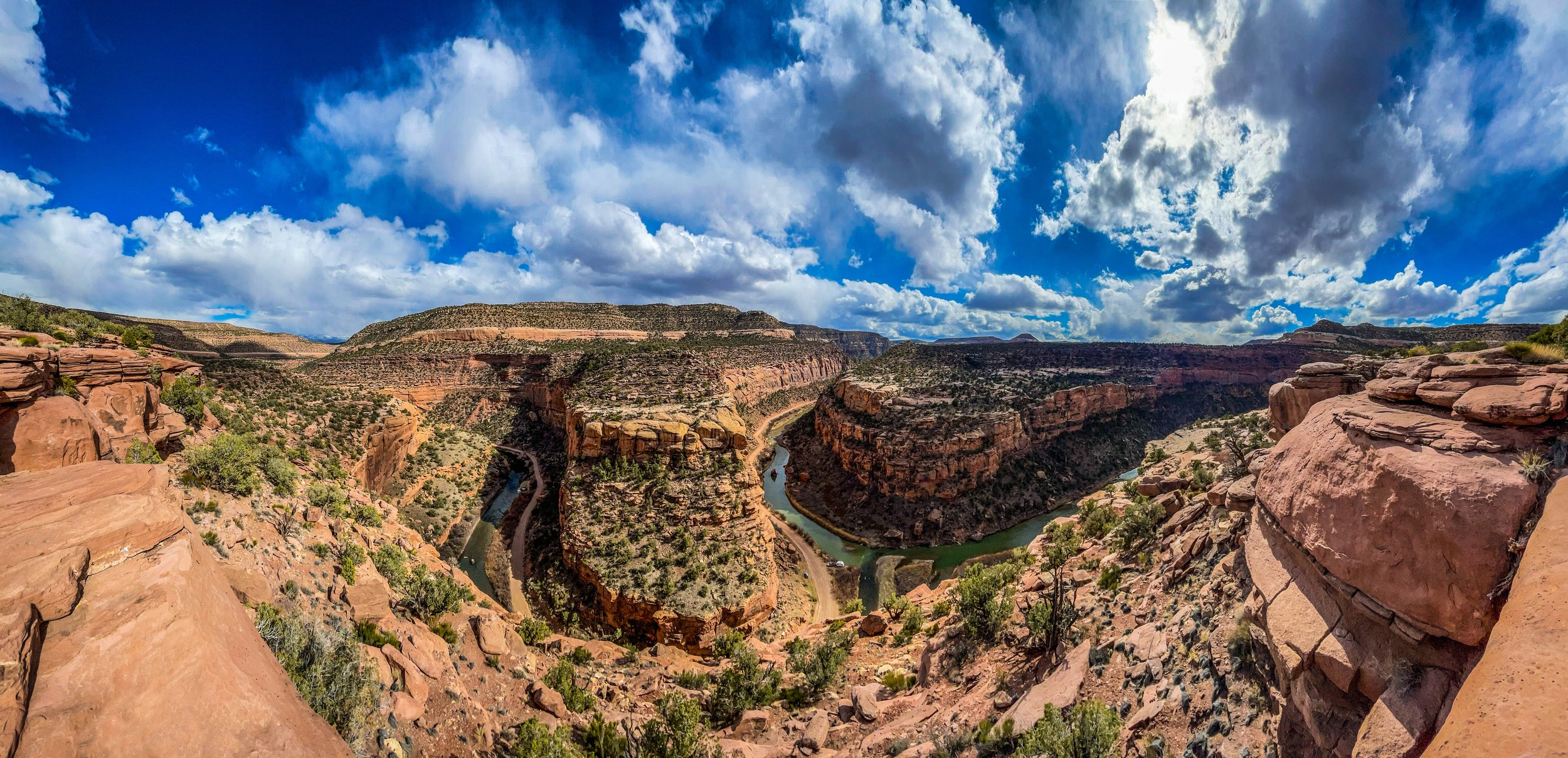
Big views and vantage points across the San Miguel Basin. The San Juan Mountains can be seen to the East, and the La Sal Mountains are up front and in charge just to the West. Plateau views of the Paradox Valley and the canyons carved by the Dolores and San Miguel Rivers give a distinct feel to the Radium loop.
Small town, slow paced vibes in Nucla, Naturita and Norwood offer several local restaurants, cafes, grocers and bike shops.
Quiet roads and trails where you can often be the only one for miles.
Unique Camping & Lodging Options. The West End offers many unique lodging & camping options, to find your niche check out westendcolorado.com/camping-lodging.
Several single track options are included on the route, or can be hopped on as a small detour: Shamrock Trail, Paradox Trail, Nucla Range Loops, Camp V Trails and Burn Canyon trails.
Must Know
When to Go: Late Spring or early Fall for the entire loop. Summer for the Rustler’s loop.
Upper elevations of the Rustler’s loop may still have snow earlier than mid-May, depending on the year’s snow levels. Those same sections could experience snow in early October as well. Mud can be a major challenge in the West End, so best to avoid times when snow-pack is melting, or after heavy rain. The Rustler’s loop also rides through Unit 61 which is a trophy hunting unit and will be busy with hunters from early October through December. Route elevation ranges from 5,000 to 10,000 feet, and the Radium loop is more prone to higher temperatures, especially in the middle of summer.
Recommended Gear: Be sure to have ample water storage, carry a water filter to take advantage of filtering in the San Miguel River and Miramonte Reservoir as well as other possible seasonal creeks. This is a high desert arid climate with large temperature swings, so check the forecast before riding and prepare your kit accordingly.
Bike/Tire Recommendations: This route offers a wide range of riding, almost all unpaved, from well graded county roads to chunky double track, to rocky single track. A hard tail is recommended for this route , but some may wish to take on the challenge of doing this with a gravel bike. Either way you go, larger volume tires are recommended as surfaces can be soft in the West End due to limited vehicle traffic. A majority of technical and rough sections can be bypassed (see caution flags on RWPGS for route alternatives).
Small cactus and sharp edge rocks are present, so bring a tire with good side-wall protection, setup tubeless with fresh sealant. This route has a good amount of climbing and descending so come with easy gearing and solid brakes.
Wildlife: This region is home to black bears, mountain lions and coyotes. Be prepared to take appropriate precautions while camping, riding at night and storing food.
Cell Phone Reception is minimal in this general area, and you likely won’t run into many humans. Make sure to download maps offline, ride smart and bring a satellite communicator (InReach or SPOT).
Camping & Lodging
The route travels through a large amount of low traffic BLM and National Forest areas which allow dispersed camping. Follow LNT practices as you traverse the land. There are also a few established campgrounds on route (which are marked on the RWGPS file):
The Vestal House in Nucla offers several unique rooms for rent, all with a bit of history. They routinely have bike packers come through!
CampV offers cabins, yurts, Airstream rentals and dispersed camping spots, along with showers and good vibes. Logistically, Camp V can be a logical place to start and end the route.
Historic Uravan Ball Park but offers an established camping area right next to the San Miguel River. There are pit privies but no potable water (you can gain access to the San Miguel for filtering).
Antone Springs Campground and Iron Spring Campground offer high elevation camping in the Uncompahgre National Forest with pit privies.
Miramonte Reservoir Campground has pit toilets and camping beside a large reservoir overlooking Lone Cone. It is very exposed and can be windy.
Food
Blondies (Naturita): Burgers & shakes in a diner setting. Closed on Saturdays, so watch hours if you’re banking on it.
Naturita Sales (Naturita): Gas station has a deli inside, and some solid pizza slices!
Wild Gals Market (Nucla) has organic groceries, fresh produce and tasty homemade treats.
5th Ave Grill (Nucla) is a sit down, hometown restaurant with breakfast, lunch and (some) dinner options.
Saucy Mama's Italian food truck (Nucla) has specialty pizza, salads, sandwiches & pasta. Outside dining or take out available. Gluten free options.
Mesa Rose Kitchen + Grocery (Norwood) has a small grocery section, tasty coffee drinks and a rotating menu of sandwiches and specials featuring local ingredients.
The Divide Restaurant (Norwood) offers daily specials for lunch & dinner and a wide range of menu items.
Lone Cone Restaurant (Norwood) is a bar with a solid dinner menu.
Bike Shops
High Country Bikes (Norwood)
Paradox Cycles (Naturita)
Both are full service shops and can help get you what you need. Hours can vary, so make sure to check times.
Trail Notes
Two distinct loops offer the ability to do one loop or both, depending on time, interest and ability. Starting in Naturita or Norwood would be the most logical places, depending on the direction in which you are coming from. Both routes can be ridden either direction, but the MTB is probably better riding CCW from CampV.
Saucer Basin, the Shamrock Trail and parts of the Paradox trail can be rough, technical and slow going with exposed rocky single track. Several hike-a-bike sections exist. Note the caution cues on the GPX file, and understand the alternatives that exist.